I have been living in Vienna's 8th district for several years now. As I have always been interested in the history of Vienna, it was only natural that I should look into the history of my neighbourhood.
The 8th district has a young history compared to other districts within the Gürtel. It was not until the end of the 17th century that the area around the Rottenhof a first settlement centre. The site was the first in the area of today's district to be parcelled out for development. Furthermore, as a successor to the Rottenhof estate, the Auersperg PalaceThe Piarist monastery was founded in 1697. In 1700, the city of Vienna bought the area, which was named Josefstadt after Prince and later Emperor Josef I.
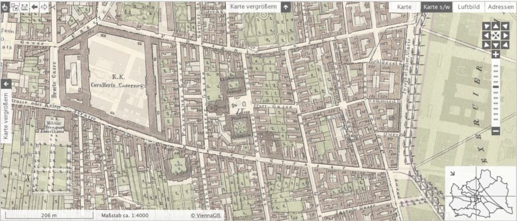
This map shows the current map of Vienna, overlaid with the historical map from 1858.

(Click on image to open map in new window)
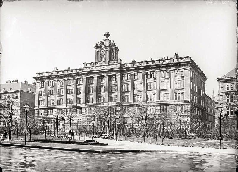
Here I have collected some old photos of Vienna, some of the buildings shown still exist (such as the Military Geographical Institute). Other buildings no longer exist, but gave the location its name, e.g. Blindeninstitut - Blindengasse.
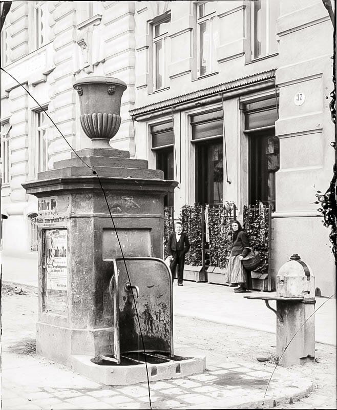
Also to be seen: A fountain in Albertgasse, which is the outlet of the Albertine water pipe was. This water pipeline was the forerunner of the high spring water pipelines and was built at the beginning of the 19th century.
The Military Geographical Institute still looks exactly the same today. After the end of the monarchy, the building housed the Federal Office of Metrology and Surveying until 1975; today it is home to part of the Vienna City Council.
Suburban houses
The suburban character, i.e. village-like structures, was still preserved in some areas of Josefstadt until the beginning of the 20th century. However, the living conditions in these old buildings were sometimes catastrophic.
Many houses had PawlatschenThese are the open (sometimes glazed) corridors on the courtyard side through which the individual flats are accessible. Some of these houses have survived to this day in the 8th district.
The Glacis
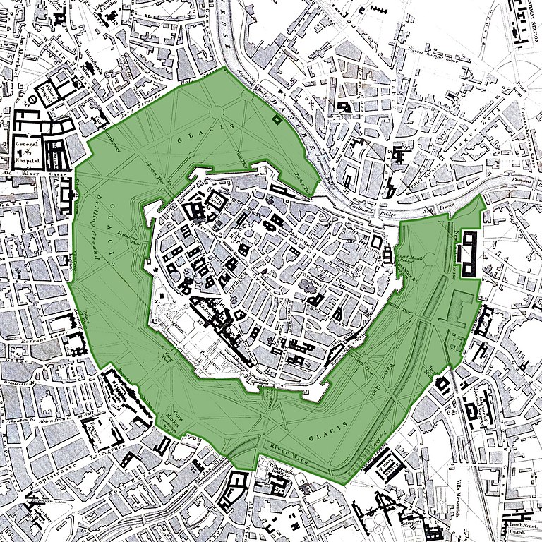
Before the reorganisation of Vienna from around 1850, the city was surrounded by an unbuilt area - the glacis - outside the city wall. It originally served defence purposes.

The first photo shows the view of Josefstadt with the Glacis; the Military Geographical Institute and the Piarist Church behind it are clearly visible.
Theatre
There were once two large theatres in Josefstadt: the Theatre in the Josefstadt (founded in 1788, the oldest theatre in Vienna) and the Municipal theatre. The latter was closed in 1960.
The Lange Gasse
Lange Gasse (nomen est omen) crosses the entire 8th district. It is also home to the oldest house, the Old bakery at number 34.
Old houses (pre-founding era)
In the course of modernisation and renewal between the middle of the 19th century and the beginning of the First World War (Gründerzeit), beautiful Baroque buildings were unfortunately also demolished. It is fortunate that the modernisation remained patchy and that older buildings (from the Baroque and Josephine periods) were preserved. Many of these older buildings can be found in the 1st and 8th districts in particular.
Churches
In the centre of the district is the Piarist Church (Maria Treu Church, built between 1716 and 1721 according to plans by J. L. von Hildebrandt). The Pfarrkirche zur kl. Dreifaltigkeit parish church is on Alserstraße and the Breitenfelder Kirche church is on Hamerlingplatz.
Palace
In the Baroque period, after the 2nd Turkish siege, Vienna experienced a boom. During this period, numerous palaces were built in Josefstadt - summer residences for the nobility. The Auersperg, Laudon, Strozzi, Trautson and Damian palaces have survived to this day.
Josefstädterstrasse
Josefstädterstraße is the district's main street and Gustav Klimt's studio was located in an inner courtyard that no longer exists today. The former Café Josefstadt is now home to a BIPA shop.
Alleys, streets and squares
Some of the alleyways and squares still look like this today, but in many cases the buildings have given way to newer structures.
Josefstädterstraße station
The old Josefstädter Straße city railway station, built by Otto Wagner. After a renovation a few years ago, the building - now a U6 station - shines in new splendour.
Image sources: ÖNB Digital, WIEN MUSEUM online collection


